
I am suspicious of anyone who claims they enjoy portaging. I don’t hate it, but I definitely don’t plan my canoe trips with the intention of carrying my canoe for long stretches of time.
Besides simply disliking them, there are plenty of reasons to want a canoe trip without portages. Maybe you’re camping with young kids and don’t want the hassle of constantly packing and unpacking your boat. Or you’re getting older and carrying a canoe overhead isn’t working for you anymore. Perhaps you just want to get lost in the rhythm of paddle stokes without the interruption of a portage trail.
Whatever your reasons are, I hope this post will help you plan a canoe trip suitable to your wants, needs and desires!
For most of the routes mentioned, I’ve linked either a trip report or a paddling guide. Trip reports are hosted on my side website, written about specific routes and go into detail on campsites, portages, access points, etc. Paddling guides, on the other hand, are written about a particular area and provide details on planning your trip and choosing a route.
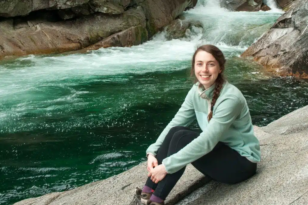
About Me: I’m Mikaela and I’m the voice behind Voyageur Tripper. I spent a few seasons wilderness guiding and now create resources to help others get outside in meaningful ways.

This post may contain affiliate links. If you make a purchase through one of these links, I may receive a small commission at no extra cost to you. Your support is much appreciated! You can learn more by reading my full disclosure.
Ontario Canoe Trips with No Portages
Here are a few canoe routes that have absolutely no portaging. There’s a mix between canoe trips on open bays, big lakes and rapid-free rivers.
1. Beausoleil Island Circumnavigation
- Type: Loop
- Distance: 25 km
- Duration: 2 – 3 days
- Difficulty: Beginner
- Paddling Guide
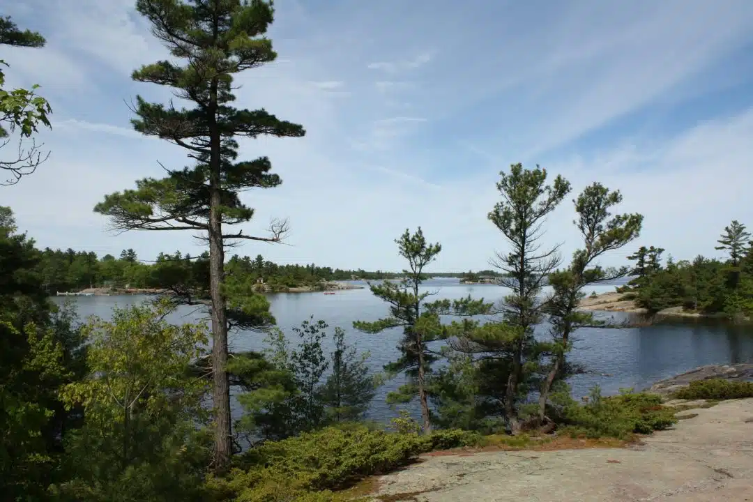
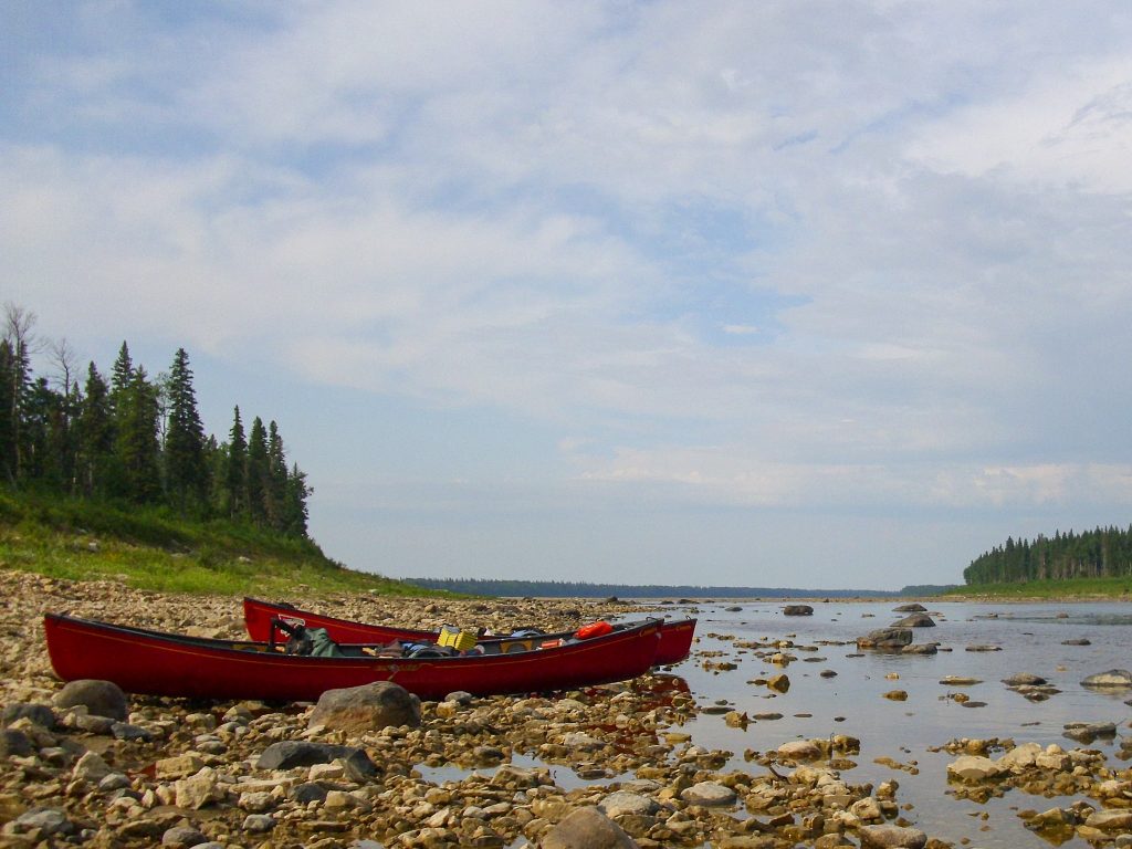
Ah, Beausoleil Island – this island is home to the camp I used to attend and sits in one of the most beautiful places in the world. Georgian Bay is a large and open body of water with tens of thousands of islands – which can be explored without ever having to do a portage.
I’ve circumnavigated Beausoleil Island many times (twice as a day trip even!). I’ve always started from camp, but you can start and end at Honey Harbour. There is paid overnight parking and a boat launch. From Honey Harbour, the entire route is about 25 km and you’ll pass by a lot of cottages and, on the weekends, a lot of motorboats. Be sure to stay along the shore and be careful crossing between islands. Technically canoes have right of way over motorboats, but that only matters if they see you.
Despite the proximity to civilization, the area is absolutely stunning. Campsites can be booked through Parks Canada – I recommend Beausoleil Point and Honeymoon Bay, which are at the bottom and top of the island, respectively.


2. Phillip Edward Island Circumnavigation
- Type: Loop
- Distance: 60 km
- Duration: 4 – 6 days
- Difficulty: Intermediate
- Trip Report
Here is another circumnavigation on Georgian Bay. Phillip Edward island is further north, close to Killarney, and is on Crown Land, so no need to book campsites. Because it’s crown land, it can be a little harder to find available campsites (and a little easier to find garbage…) on summer weekends.
The put-in and take-out for this route are Chikanishing Trail, which is part of Killarney Provincial Park and requires an overnight parking permit. This can be purchased from the Visitor’s Center on George Lake.
The south shore of Phillip Edward Island is sprinkled with small islands, which can be a little confusing to navigate, and the area is subject to the windy and wavy conditions of Georgian Bay. The north shore isn’t as scenic, but it’s much more sheltered.
The photos below are by Jesse Yacoubov who wrote the Phillip Edward Island trip report.


3. Spanish River: Duke Lake to The Forks
- Type: One Way
- Distance: 44 km
- Duration: 3 – 4 days
- Difficulty: Beginner
- Paddling Guide
This is perhaps the least conventional route on this list. Most people who paddle the Spanish River do so for the whitewater. The West Branch, starting at Biscotasing Lake, and the section below The Forks have tons of rapids for the whitewater enthusiast.
The East Branch, which goes from Duke Lake to The Forks, doesn’t have any portages. The branch is a series of lakes connected to one another by small (very small!) swifts. It does have a few rapids – namely Cavana Rapids, Breadner Swifts and Kingfisher Swifts – which are all suitable for novice whitewater paddlers (if at least someone in your group knows whitewater paddling). You can see the rapids in this YouTube video I made.
Duke Lake is only a few meters off the side of Highway 144, making it an easy place to put in and leave a vehicle. The tricky part of this route is getting off the river at The Forks (before all the whitewater happens). Once at The Fork, you’ll need to paddle upstream for 1.5 km (the current isn’t strong so it’s annoying but not difficult) to make it to The Forks train stop. Call VIA Rail in advance to organize your pickup.


4. Moose River
- Type: One Way
- Distance: 70 km
- Duration: 4 – 6 days
- Difficulty: Intermediate
- Trip Report
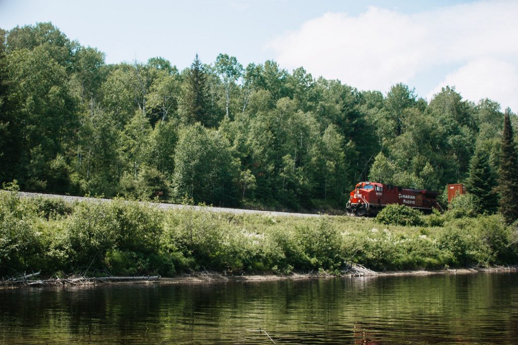
The Moose River is spectacular. It’s quite far and a little logistically difficult to plan a trip here, but if you’re willing to put in the work you will be rewarded with an incredible canoe trip. I paddled the Moose River as part of my three-week Missinaibi River trip, but you can paddle just the Moose River over 4-5 days.
From Cochrane, you’ll hop aboard the Polar Bear Express heading toward Moosonee. The put in is at Moose Crossing, where the train crosses over the Moose River (as pictured below). From there it’s about 70 km to Moosonee, where you’ll hop back on the Polar Bear Express bound for Cochrane.
Campsites are easy to find along the river and Missinaibi: Journey to the Northern Sky is a fantastic resource. In the late summer, you may be able to catch the northern lights! Though be mindful that water levels can drop in late summer and you may need to drag your boats a little.


5. Upper Ottawa River: Mattawa to Driftwood Provincial Park
- Type: One Way
- Distance: 72 km
- Duration: 4 – 6 days
- Difficulty: Intermediate
I’ve only paddled a small section of the Upper Ottawa River, but let me tell you, it is a real beauty. The river is wide and the current appears slow-moving; you won’t encounter any whitewater on this route, so there’s really no need to get out of your canoe.
If you don’t mind two small and unofficial portages in town, you can put in at Chant Plein Lake just west of Mattawa. There is an unofficial boat launch and free parking here. Otherwise, there is Valois’ Motel & Restaurant on the outside of Mattawa which has a dock and overnight parking for $20 per day.
There aren’t any good resources for finding campsites along this stretch of river, but I did find this one trip report on MyCCR which details some of the campsite locations.
The best place to take out is at Driftwood Provincial Park (shortly after the park there is a dam you’d need to portage around if you wanted to keep going). I’ve camped at Driftwood and it’s a beautiful little park.


6. Pukaskwa: Hattie Cove to Michipicoten River
- Type: One Way
- Distance: 170 km
- Duration: 10 days
- Difficulty: Advanced
- Trip Report
The last portage-free canoe trip I’ll include is a one way journey along the northern shore of Lake Superior. There are dozens of potential routes of varying distances, so I’ll only specify one in Pukaskwa National Park.
Start at Hattie Cove and the Pukaskwa National Park visitor’s centre and paddle south. You’ll pass rivers that empty into Lake Superior and weave in between islands dotting the coastline. There’s a good mix between rocky and sandy campsites, depending on what you prefer.
Really the only suitable place to end the route is at Michipicoten River, 170 km south, so this is a big trip. It’s also quite exposed and you’ll need to be comfortable with big water paddling to safely execute the trip. But if you’re experienced, this is an excellent canoe trip with absolutely no portaging.
The following photos were taken by Swamp Walker, who wrote the Pukaskwa trip report.


Bonus: Lake of the Woods
I don’t know enough about this area to have a route recommendation, but I want to call out Lake of the Woods, an area near the southern part of the Ontario-Manitoba border. This area appears to have just as much water as it has land – like it’s a mix of Georgian Bay (little land on big water) and Algonquin (little water on big land).
Looking at the map, it seems you could plan a few different routes without having any portages. There’s boat launches off of the Trans-Canada Highway and tons of big, intersecting lakes to choose from. If anyone has paddled here, please let me know!
Ontario Canoe Trips with Minimal Portages
This section contains Ontario canoe routes that have very little portaging – typically less than 200 m per day. Although you’ll still have to carry a canoe at least once, I’ve tried to include routes where a small portage is well worth the destination on the other side.
7. French River: Dry Pine Bay to Hartley Bay
- Type: One Way
- Distance: 32 km
- Total Portage Distance: 100 m
- Duration: 3 days / 2 nights
- Difficulty: Beginner
- Paddling Guide
This route takes you through a beautiful section of the French River. Put in on Dry Pine Bay at Loon Landing and paddle south to meet up with the French River (alternatively, you could put in on the French River at the supply post and save yourself 3 km of paddling). From there, you’ll paddle in between the steep granite walls lining the sides of the river.
There are only two portages on this one-way route: one 70 m portage around Recollet Falls and one 30 m portage around Little Flat Rapids. There are no portages or features between Little Flat Rapids and Hartley Bay, where you can take out.
If you want a little more distance for your trip, add a route around Merranger’s Island. This will add about 11 km of paddling and contains no portaging.

8. Algonquin: Achray Campground to High Falls
- Type: Out and Back
- Distance: 20 km
- Total Portage Distance: 100 m
- Duration: 2 days / 1 night
- Difficulty: Beginner
- Trip Report
High Falls is a popular destination in Algonquin Provincial Park for its natural waterslide. The easiest way to access the falls is from Achray Campground, which is only 10 km away and requires just one 50 m carryover between Grand Lake and Stratton Lake. There are campsites on Stratton Lake very close to the falls, but make your reservation early if going on the weekend – it’s a popular spot!


9. Tim River to Longbow Lake
- Type: Out and Back
- Distance: 32 km
- Total Portage Distance: 240 m
- Duration: 2 days
- Difficulty: Beginner
- Trip Report
Tim River is a slow-moving, moose-frequented river on the east side of Algonquin. With the exception of one 120 m portage into Tim Lake (and a few lifts over beaver dams), this route keeps you in your canoe and off the trails. Starting at Access Point #2, the route paddles 16 km into the park, passing through several sections of the winding Tim River toward Rosebary Lake and Longbow Lake.
These photos were taken by Raina Freidman who wrote the Tim River trip report.


10. French River Loop: West Channel Loop
- Type: Loop
- Distance: 52 km
- Total Portage Distance: 170 m
- Duration: 3 – 4 days
- Difficulty: Intermediate
- Trip Report
Another great option for a minimal-portaging canoe trip is the French River Delta, where the river splits into several channels and meets Georgian Bay. A popular route is to paddle down the Western Channel, along the northern shore of Georgian Bay and back up either through the Main Outlet or the Eastern Outlet (or you can do it all in reverse).
The route creates a nice loop, with paddling through narrow sections of Canadian Shield or around small, rocky islands. Coming down the Western Channel, you’ll be forced to do the 110 m portage around Lilly Chute. If you take the Main Outlet, there’s a 310 m portage around Dalles Chute. We want to minimize portaging however, so you can take the Eastern Outlet instead, which has two portages, but they are significantly shorter: 10 m and 50 m.
The photos below were taken by Sean Vandersluis who wrote the West Channel Loop trip report.


11. Matagamasi Lake to Wolf Lake
- Type: Out and Back
- Distance: 30 km
- Total Portage Distance: 1000 m
- Duration: 2 – 3 days
- Difficulty: Beginner
- Trip Report
Perhaps this route has too much portaging to be included. But considering it’s in Temagami (a region notorious for its long, frequent and difficult portages), I think this can be considered a minimal portaging route. Plus, it includes Wolf Lake, one of my favourite destinations in all of Temagami. This was the last lake I camped at during my first big canoe trip in 2010. We took a rest day on Wolf Lake and paddled to Paradise Lagoon and it’s one of the best memories I have.
The route kicks off from the boat launch on the south end of Matagamasi Lake and goes north to Silvester Lake and then Wolf Lake, passing by Paradise Lagoon along the way. There are two portages (200 m and 300 m) each way and they’re both pretty easy.


Ontario Canoe Routes with Little to No Portages
I hope this post has been helpful and you’ve found the destination for your next portage-free canoe trip. Let me know if you’ve tried any of the routes or if there’s a good one I’ve left off the list! Here are some additional canoeing resources you may find helpful!
- How to Portage a Canoe + 12 Expert Tips to Make it Easier
- The ULTIMATE Guide to Canoe Camping
- How to Find Canoe Routes: 9 Resources for Planning Your Next Canoe Trip!
Stay in Touch
Join our community of outdoor adventurers - you'll find trip inspiration, gear discussions, route recommendations, new friends and more!
Trip # 11 looks interesting. Are all the 4 pictures of the Paradise Lagoon?
Yes they are! All Paradise Lagoon / Wolf Lake. Here is a trip report for the route: https://tripreports.voyageurtripper.com/chiniguchi-laura-lake-loop/
This was an awesome read, I’ve canoed for 25+ years and I’m looking for something different… I believe you have talked me into the Moose river trip lol. Thanks !
Looking for canoe routes for black River Matheson area.